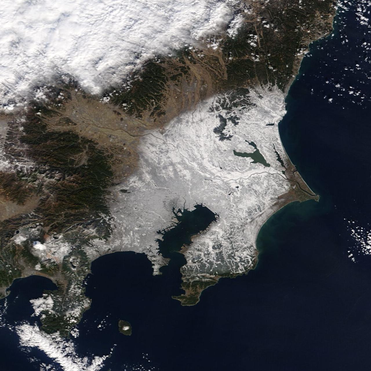
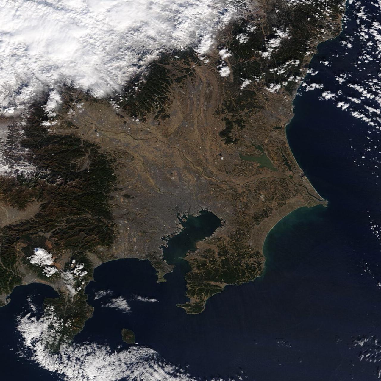
これらの画像は、NASA(アメリカ航空宇宙局)の地球観測衛星テラがとらえた関東地方の画像です。1枚目は2022年1月7日、2枚目は1月5日に撮影されました。
本州の南海上を東へ移動する、いわゆる「南岸低気圧」などの影響により、1月6日には関東地方の広い範囲で雪が降りました。東京都心では10センチメートルの積雪があったそうです。1月5日の画像では平野部には全く雪が見られませんが、1月7日の画像を見ると広範囲が白くなっているのが分かります。
We acknowledge the use of imagery from the NASA Worldview application (https://worldview.earthdata.nasa.gov), part of the NASA Earth Observing System Data and Information System (EOSDIS).
(参照)NASA Worldview
 大宇宙 写真集500【改訂新版】
 探査機が見た太陽系【第4版】
 ジェイムズ・ウェッブ宇宙望遠鏡がみた宇宙【改訂版】