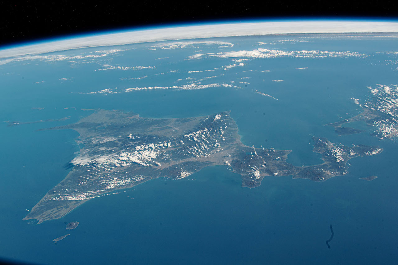
この画像は、ISS(国際宇宙ステーション)から北海道をとらえたものです。2023年10月13日13時48分ごろ(日本時間、以下同じ)に撮影されました。画像上には水平線が見えており、画像右端には青森県の一部も映っています。
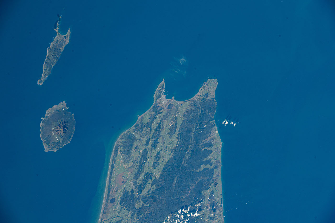
こちらはISSから撮影された稚内付近の写真です。10月13日13時49分ごろに撮影されました。左側には利尻島(下)や礼文島が映っています。
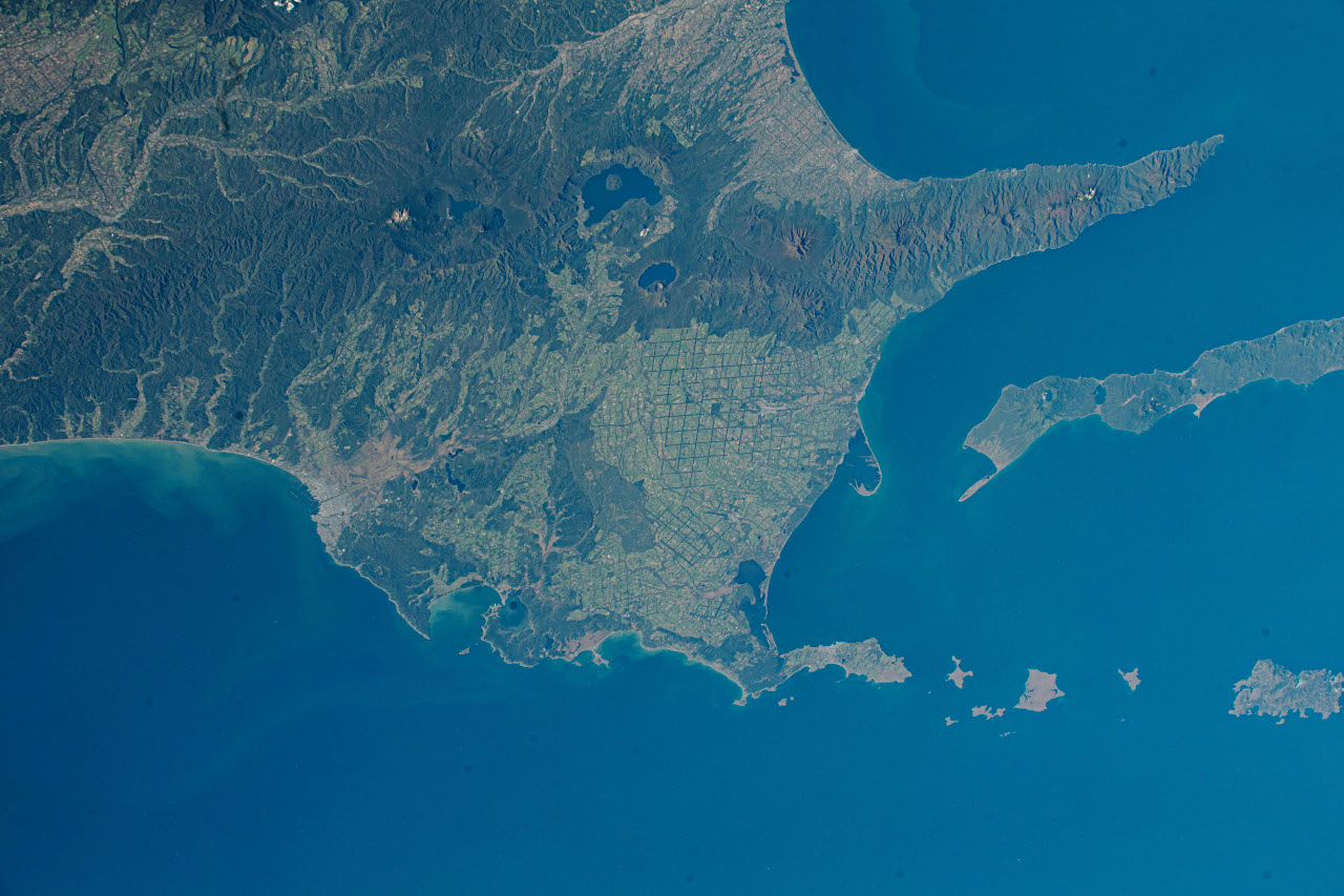
こちらは13時50分ごろ撮影された写真です。北海道東部を映したもので、知床半島や根室半島などが見えています。根釧台地の格子状防風林が特徴的です。
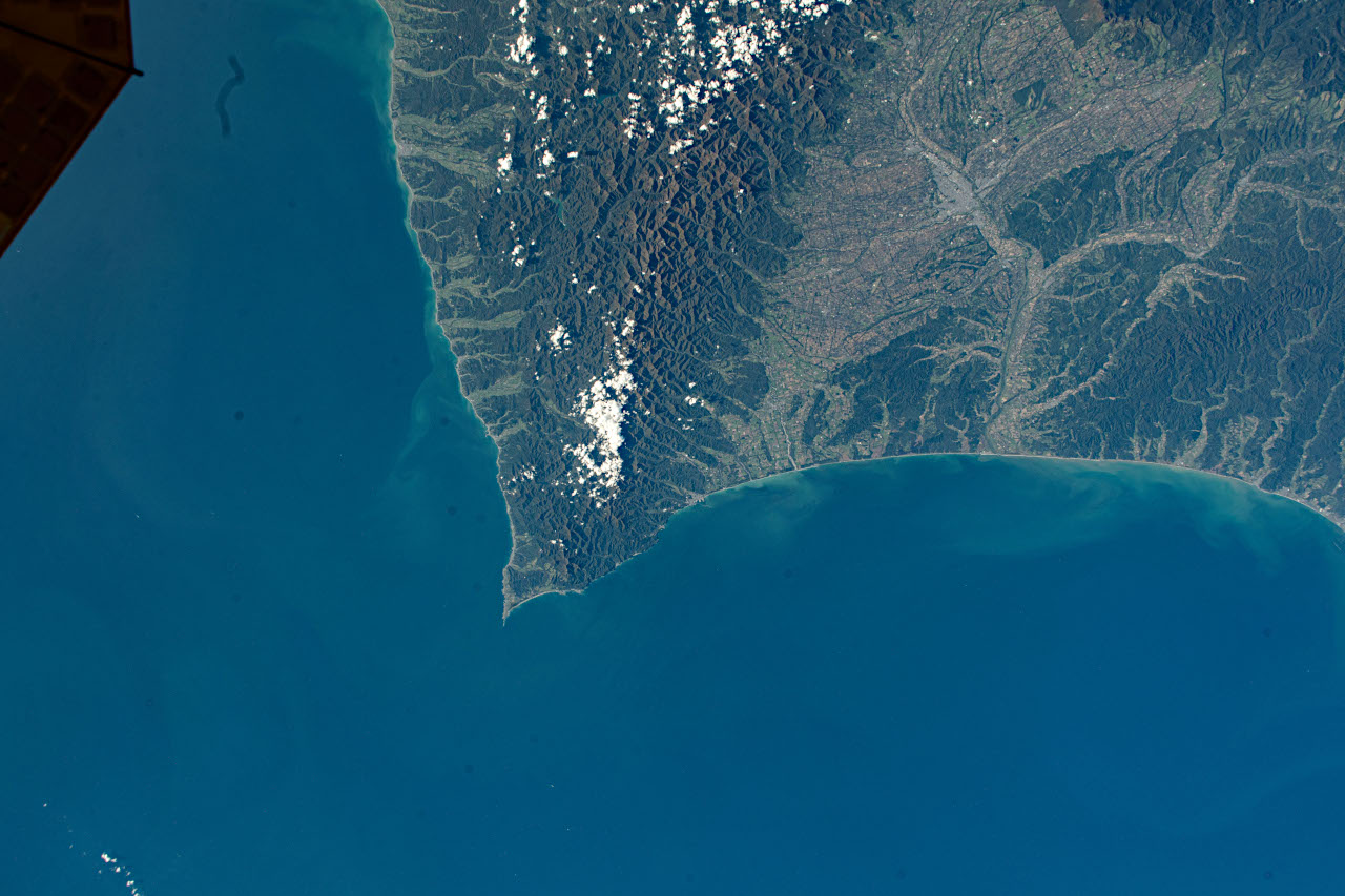
こちらの写真に映っているのは北海道の襟裳岬周辺です。13時50分ごろ撮影。
画像のメタデータによれば、いずれの画像も撮影者は、現在、ISSに長期滞在しているJAXA(宇宙航空研究開発機構)の古川聡宇宙飛行士となっています。
Image courtesy of the Earth Science and Remote Sensing Unit, NASA Johnson Space Center
(参照)Gateway to Astronaut Photography of Earth(1)、(2)、(3)、(4)
 大宇宙 写真集500【改訂新版】
 探査機が見た太陽系【第4版】
 ジェイムズ・ウェッブ宇宙望遠鏡がみた宇宙【改訂版】