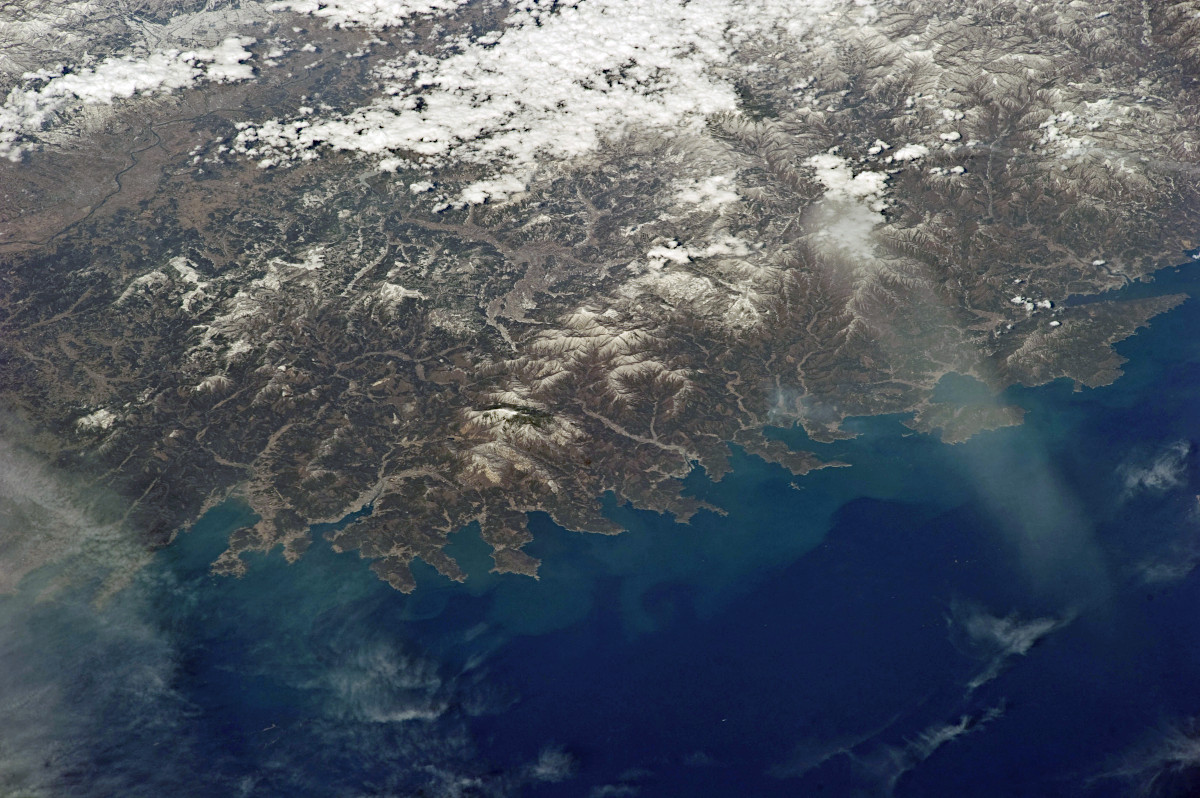
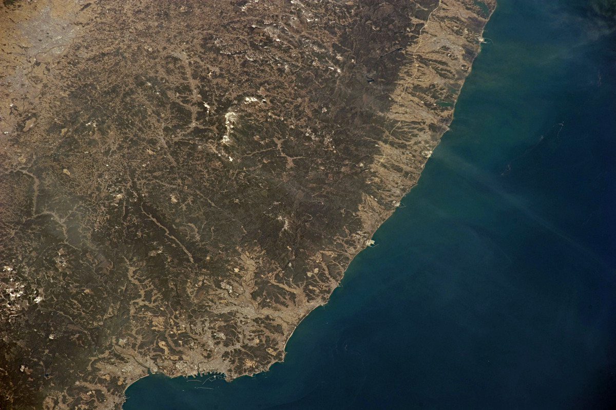
ここで紹介する一連の写真は、東日本大震災を引き起こした大地震から3日後の2011年3月14日に、ISS(国際宇宙ステーション)から撮影されたものです。北は仙台付近から南は銚子付近までの太平洋岸を撮影した7枚の写真です。いずれも午前9時35分ごろに撮影されました。
写真右上は宮城県石巻市の一部や東松島市、左下は福島県南相馬市あたりまでが映っています。
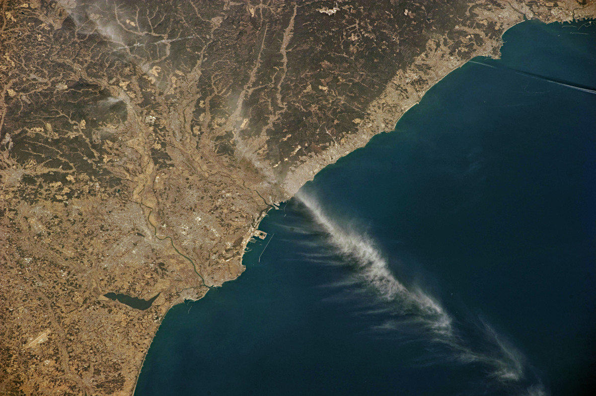
宮城県名取市あたりから福島県大熊町あたりまでが映っています。写真下のほうに福島第一原子力発電所が映っています。
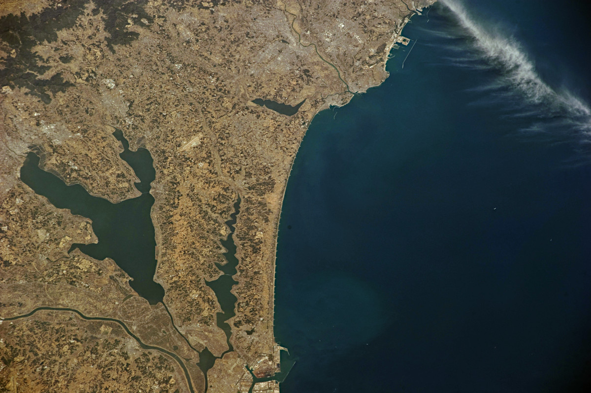
福島県南相馬市あたりから、いわき市あたりまでが映っています。この写真には福島第一原子力発電所と第二原子力発電所が映っています。

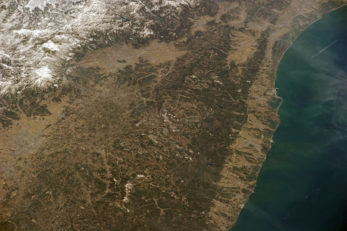
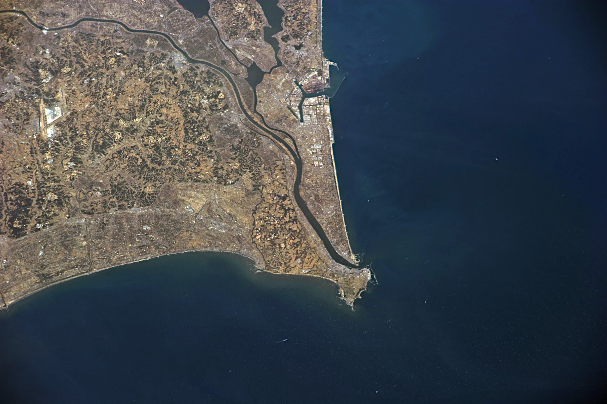
福島県楢葉町あたりから茨城県日立市あたりまでが映っています。
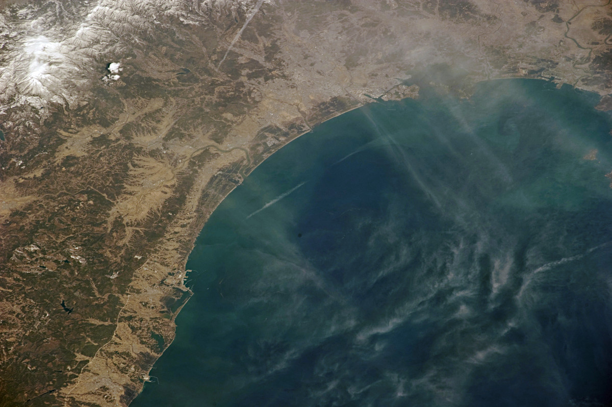
福島県いわき市あたりから茨城県鉾田市あたりまでが映っています。
茨城県東海村あたりから鹿島市あたりまでが映っています。内陸には霞ヶ浦や北浦も見えています。
茨城県鹿島市あたりから銚子を経て九十九里の海岸が映っています。
Image courtesy of the Earth Science and Remote Sensing Unit, NASA Johnson Space Center
(参照)Gateway to Astronaut Photography of Earth(1)、(2)、(3)、(4)、(5)、(6)、(7)
 大宇宙 写真集500【改訂新版】
 探査機が見た太陽系【第4版】
 ジェイムズ・ウェッブ宇宙望遠鏡がみた宇宙【改訂版】